Floresta, Bayshore and Northport, the city's Planning Area 3, have about 18,400 single-family homes in ZIP codes 34983 and 34984, split among three high schools.
Last checked Oct. 10, 2026. Sources: the City of Port St. Lucie’s neighborhood map, parcel layer and parks list, St. Lucie Public Schools’ school locator, the Florida Department of Education’s 2026 school grades, the Zillow Home Value Index (Zillow Research) and © OpenStreetMap contributors.
Floresta, Bayshore and Northport make up Planning Area 3 on the City of Port St. Lucie’s neighborhood map: eight named neighborhoods covering about 12.6 square miles in the older, eastern half of the city. The city’s parcel layer counts about 18,400 single-family homes there, most of them on the grid of streets laid out when the city was first developed, plus about 770 vacant residential lots. About 13,500 of the homes are in ZIP code 34983 and about 4,900 in 34984.
What this means for you
- High school: split three ways. St. Lucie West Centennial High (B for 2026) for most of the area, Port St. Lucie High (A) in the south and Fort Pierce Central High (C) in Northport Village.
- Home value: $361,472 in ZIP code 34983 and $394,493 in 34984 in August 2026, according to the Zillow Home Value Index.
- Nearest highway exit: Florida’s Turnpike exit 142 (Port St. Lucie), about 3.2 miles by road from the middle of the area; I-95 is about 6 miles west.
Part of our Port St. Lucie neighborhoods guide.
Where it is
The city’s map divides Planning Area 3 into Northport Village (about 2.8 square miles), the Bayshore Business District (0.7), Swan Park (1.8), Bayshore Heights (1.6), Canal Pointe (1.2), Riverview (1.8), Floresta Gardens (1.4) and Floresta Pointe (1.2). Together they sit east of Florida’s Turnpike, with the North Fork of the St. Lucie River along part of the eastern side.
Bayshore Boulevard, Airoso Boulevard and Floresta Drive carry traffic north and south. Prima Vista Boulevard, Crosstown Parkway and Port St. Lucie Boulevard cross the area east to west. City Hall, at 121 SW Port St. Lucie Blvd., is about 2.2 miles by road from the middle of the area.
Schools
St. Lucie Public Schools’ locator shows a zoned high school for each address. We checked 120 homes picked at random from the city’s parcel layer:
| Neighborhood | Zoned high school in our check |
|---|---|
| Northport Village | Fort Pierce Central High |
| Swan Park, Floresta Gardens, Floresta Pointe | St. Lucie West Centennial High |
| Bayshore Heights, Canal Pointe | Port St. Lucie High |
| Riverview | Split: St. Lucie West Centennial High and Port St. Lucie High |
Elementary, K-8 and middle school places go through the district’s Student Assignment application. District schools inside the area, with Florida’s grades:
| School | Address | 2026 grade | 2025 grade |
|---|---|---|---|
| Bayshore Elementary | 1661 SW Bayshore Blvd. | B | B |
| Floresta Elementary | 1501 SE Floresta Drive | C | C |
| Northport K-8 | 250 NW Floresta Drive | C | B |
Check an exact address on the school locator and see our schools guide for every school in the city.
Home values
The typical home value in ZIP code 34983 was $361,472 in August 2026, down 1.3% from $366,379 in August 2025. In ZIP code 34984 it was $394,493, down 1.4% from $399,988. Zillow’s figure for Port St. Lucie as a whole was $384,593, down 1.3%. The Zillow Home Value Index is a modeled typical value for the middle third of homes, single-family houses and condos together, not a sale price. Both ZIP codes reach beyond this area: 34983 also covers St. Lucie North, and 34984 covers Southbend Lakes. More in our home prices guide.
Parks and trails
The city’s parks list and parks map put 16 parks and facilities inside the area, including:
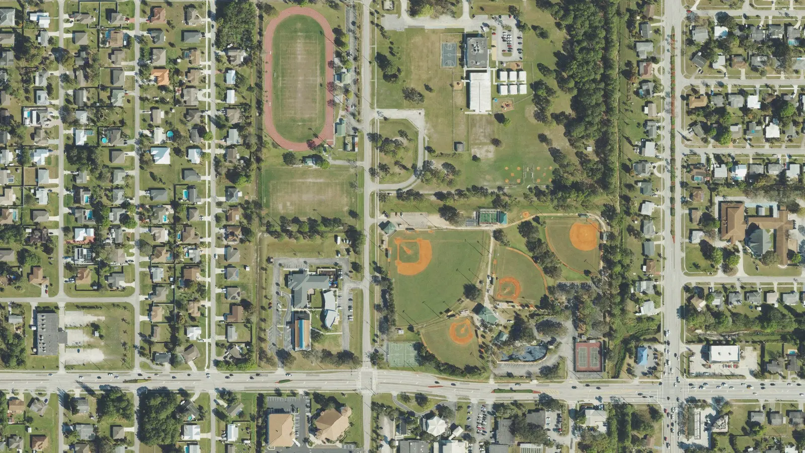
- Sportsman’s Park, 201 NW Prima Vista Blvd., about 16 acres with ball fields, basketball and tennis courts and a playground, and Sportsman’s Park West, 220 NW Irving St., with a running track.
- Jaycee Park, 1301 SW Bayshore Blvd., and Swan Park, 700 SW Carmelite St.
- Kiwanis Park, 1320 SE Floresta Drive, and Fred Cook Park, 400 SE Glenwood Ave.
- Girl Scout Friendship Park, 315 NW Heather St., and Gulf Stream Park, 210 NE Ardsley Drive.
- C-24 Canal Park, 500 SE Oakridge Drive, with four boat ramp lanes and river and ocean access.
- The Port St. Lucie Community Center, 2195 SE Airoso Blvd.
More in our parks and trails guide.
Getting around
- Florida’s Turnpike: exit 142 (Port St. Lucie), about 3.2 miles by road.
- I-95: exit 120 (Crosstown Parkway), about 5.8 miles; exit 121 (St. Lucie West Boulevard), about 5.9 miles.
- City Hall (121 SW Port St. Lucie Blvd.): about 2.2 miles.
- President Donald J. Trump International Airport (PBI), the former Palm Beach International: about 52 miles.
These are distances on the OpenStreetMap road network, measured with the OSRM routing engine from a home near the middle of the area, not drive times. St. Lucie County’s fare-free Area Regional Transit buses serve the city; routes and stops are on the county’s page. More in our getting around guide.
Groceries and everyday stores
OpenStreetMap lists a Walgreens on SW Prima Vista Boulevard and a Winn-Dixie and a Walgreens on SW Port St. Lucie Boulevard near the area’s southern end. A Publix and a Walgreens are on U.S. 1 to the northeast, and an ALDI and a Walmart Neighborhood Market are on SW St. Lucie West Boulevard, each about 3 miles by road from the middle of the area.
How we drew this area
This page follows the eight Planning Area 3 neighborhoods on the City of Port St. Lucie’s neighborhood map. Home counts and ZIP codes come from the city’s parcel layer on Oct. 10, 2026: parcels with a state land use code for a single-family home, counted where the parcel’s center falls inside a neighborhood. The city gives no home counts of its own. A random sample of homes was checked against the district’s school locator. Store locations and road distances use © OpenStreetMap contributors.
Frequently asked questions
What high school is Floresta in Port St. Lucie zoned for?
It depends on the street. In our check of 120 homes on the district’s school locator, Swan Park, Floresta Gardens and Floresta Pointe were zoned for St. Lucie West Centennial High, Bayshore Heights and Canal Pointe for Port St. Lucie High, and Northport Village for Fort Pierce Central High.
What ZIP code is Bayshore in Port St. Lucie?
Most of the area uses 34983 and the southern part uses 34984. The typical home value was $361,472 in 34983 and $394,493 in 34984 in August 2026, according to the Zillow Home Value Index.
Is Floresta a good place to live?
Here are the facts. Floresta, Bayshore and Northport have about 18,400 single-family homes, three district elementary or K-8 schools graded B or C for 2026 and 16 parks and facilities on the city’s parks layer. The typical home value in 34983 was $361,472 in August 2026, according to Zillow.
What parks are in the Bayshore area of Port St. Lucie?
The city’s parks layer lists Sportsman’s Park, Sportsman’s Park West, Jaycee Park, Swan Park, Kiwanis Park, Fred Cook Park and C-24 Canal Park among others, plus the Port St. Lucie Community Center on Airoso Boulevard.
Have your say