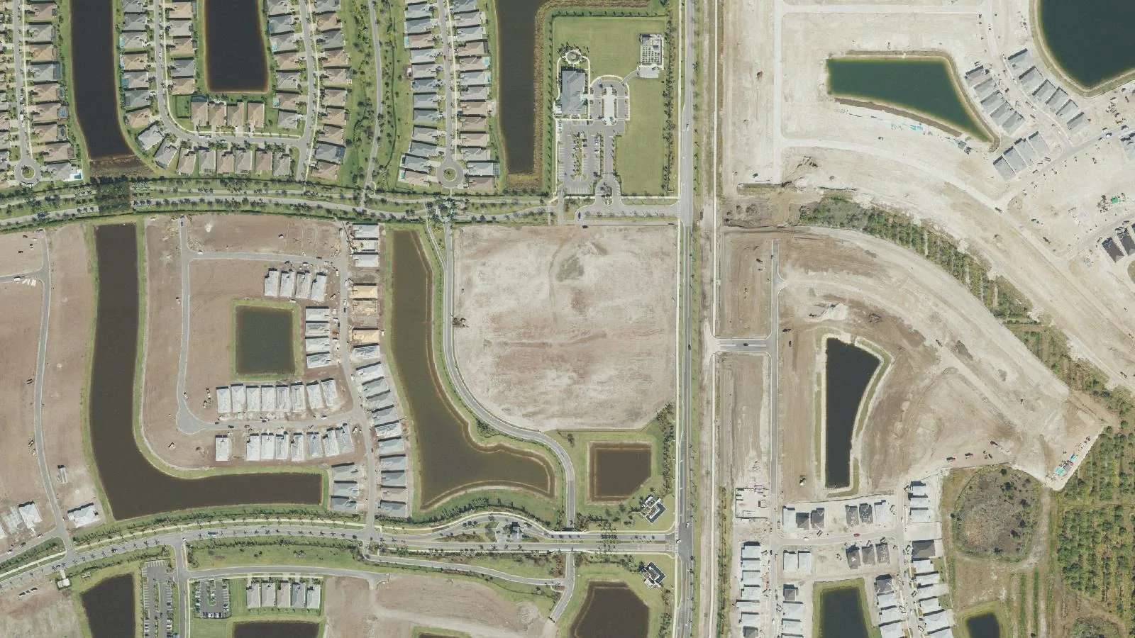
Riverland/Kennedy and Wilson Groves, on the city's western edge along Becker Road, had about 3,600 homes and 2,000 vacant lots in ZIP code 34987 in October 2026.
Last checked Oct. 10, 2026. Sources: the City of Port St. Lucie’s neighborhood map, parcel layer and parks list, St. Lucie Public Schools’ school locator, the Florida Department of Education’s 2026 school grades, the Zillow Home Value Index (Zillow Research) and © OpenStreetMap contributors.
The City of Port St. Lucie’s neighborhood map draws two large neighborhoods on the city’s southwestern edge, west of Tradition: Riverland/Kennedy, about 6 square miles, and Wilson Groves, about 3.9 square miles. Both are still being built. In October 2026 the city’s parcel layer counted about 3,600 single-family homes, nearly all in Riverland, and about 2,000 vacant residential lots. Every home is in ZIP code 34987.
What this means for you
- High school: Legacy High, for every address we checked. State grade B for 2026, its first year.
- Home value: $447,511 in ZIP code 34987 in August 2026, according to the Zillow Home Value Index.
- Nearest highway exit: I-95 exit 118 (Gatlin Boulevard and Tradition Parkway), about 2.7 miles by road from the middle of Riverland.
Part of our Port St. Lucie neighborhoods guide.
Where it is
On the city’s map, the two neighborhoods sit between Community Boulevard on the east, the edge of Tradition, and Range Line Road on the west. Becker Road runs east to west through Riverland. Wilson Groves is the southern part, near the Martin County line, and had only 14 homes on the parcel layer.
Schools
St. Lucie Public Schools’ locator shows a zoned high school for each address. For the 160 homes we checked, picked at random from the city’s parcel layer, every one was zoned for Legacy High, 14505 SW Crosstown Parkway, which the district’s school site says opened for 2025-26. Florida graded it B for 2026. The federal school directory lists no district school inside the two neighborhoods.
Elementary, K-8 and middle school places go through the district’s Student Assignment application. Check an exact address on the school locator and see our schools guide.
Home values
The typical home value in ZIP code 34987 was $447,511 in August 2026, down 2.0% from $456,556 in August 2025. Zillow’s figure for Port St. Lucie as a whole was $384,593, down 1.3%. The Zillow Home Value Index is a modeled typical value for the middle third of homes, single-family houses and condos together, not a sale price. ZIP code 34987 also covers Tradition and most of Verano. More in our home prices guide.
Parks and trails
From the city’s parks list:
- Riverland Paseo Park, 12151 SW Community Blvd.: a new 12-acre community park the city says is designed for families, residents and pet owners.
- McCarty Ranch Preserve, 12525 Range Line Road, northwest of the area: a 3,100-acre city nature and water-storage preserve with multiuse trails, lakes for paddling and fishing, disc golf and rustic camping.
More in our parks and trails guide.
Getting around
- I-95: exit 118 (Gatlin Boulevard and Tradition Parkway), about 2.7 miles by road; exit 120 (Crosstown Parkway), about 5.4 miles; exit 114 (Becker Road), about 5.5 miles.
- Florida’s Turnpike: exit 142 (Port St. Lucie), about 7.7 miles.
- City Hall (121 SW Port St. Lucie Blvd.): about 8.3 miles.
- President Donald J. Trump International Airport (PBI), the former Palm Beach International: about 53 miles.
These are distances on the OpenStreetMap road network, measured with the OSRM routing engine from a home near the middle of Riverland, not drive times. The city’s Jobs Express Terminal, 2198 SW Gatlin Blvd., at exit 118, is the stop for the Palm Tran express bus to West Palm Beach. More in our getting around guide.
Groceries and everyday stores
OpenStreetMap lists Publix at 12407 SW Community Blvd., about 2 miles by road from the middle of Riverland. In Tradition are Publix at 10400 SW Village Center Drive and The Fresh Market at 10272 SW Meeting St., each under 3 miles, and a Walgreens is at 1954 SW Gatlin Blvd.
How we drew this area
This page follows the Riverland/Kennedy and Wilson Groves boundaries on the City of Port St. Lucie’s neighborhood map; the city gives neither a planning area number. Home counts and ZIP codes come from the city’s parcel layer on Oct. 10, 2026: parcels with a state land use code for a single-family house. New homes may still be listed as vacant lots until the parcel record is updated. A random sample of homes was checked against the district’s school locator. Store locations and road distances use © OpenStreetMap contributors.
Frequently asked questions
What high school is Riverland in Port St. Lucie zoned for?
Legacy High, 14505 SW Crosstown Parkway, for every Riverland and Wilson Groves address we checked on the district’s school locator. Florida graded it B for 2026.
Where is Riverland in Port St. Lucie?
On the city’s western edge, west of Tradition, with Becker Road running through it and Range Line Road along its western side. The city’s map labels it Riverland/Kennedy.
Is Riverland a good place to live?
Here are the facts. Riverland/Kennedy and Wilson Groves had about 3,600 homes and about 2,000 vacant residential lots on the city’s parcel layer in October 2026, with Riverland Paseo Park opened on Community Boulevard. Homes are zoned for Legacy High, graded B for 2026, and the typical home value in 34987 was $447,511 in August 2026, according to Zillow.
What is at Riverland Paseo Park?
The city describes it as a new 12-acre community park in western Port St. Lucie for families, residents and pet owners, at 12151 SW Community Blvd.
Have your say