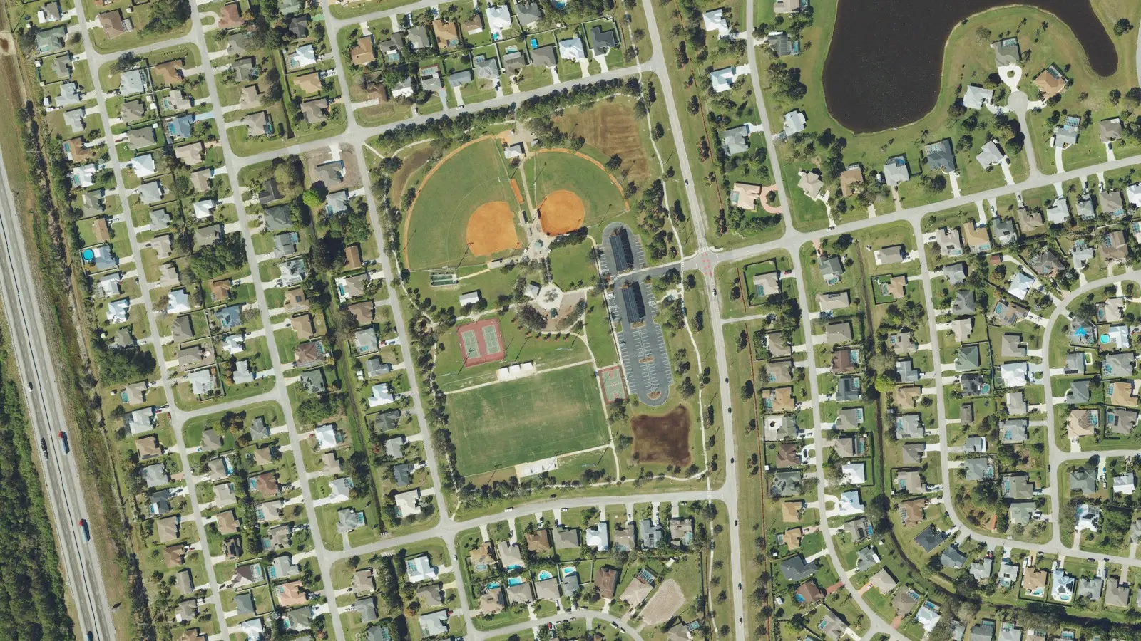
Southbend Lakes, east of Florida's Turnpike along Becker Road, has about 3,700 single-family homes and 1,200 vacant lots, almost all in ZIP code 34984.
Last checked Oct. 10, 2026. Sources: the City of Port St. Lucie’s neighborhood map, parcel layer and parks list, St. Lucie Public Schools’ school locator, the Florida Department of Education’s 2026 school grades, the Zillow Home Value Index (Zillow Research) and © OpenStreetMap contributors.
Southbend Lakes is Planning Area 5 on the City of Port St. Lucie’s neighborhood map: about 6.7 square miles in the southeast of the city, east of Florida’s Turnpike and reaching south to the Martin County line. The city’s parcel layer counts about 3,700 single-family homes there and about 1,200 vacant residential lots. Nearly every home is in ZIP code 34984; about 20 at the southern edge use 34990.
What this means for you
- High school: split. Port St. Lucie High (A for 2026) in the northern part and Treasure Coast High (B for 2025; 2026 grade incomplete) in the southern part.
- Home value: $394,493 in ZIP code 34984 in August 2026, according to the Zillow Home Value Index.
- Nearest highway exit: Florida’s Turnpike exit 138 (Becker Road), about 1.6 miles by road from the middle of the area. I-95 exit 114 is about 5.6 miles.
Part of our Port St. Lucie neighborhoods guide.
Where it is
On the city’s map, Southbend Lakes lies between Florida’s Turnpike on the west and the North Fork of the St. Lucie River to the east, with the County Line Canal at its southern end. Becker Road crosses the southern part east to west, and Southbend Boulevard runs north and south through it. City Hall, at 121 SW Port St. Lucie Blvd., is about 7.8 miles by road from the middle of the area.
Schools
St. Lucie Public Schools’ locator shows a zoned high school for each address. Of the 120 homes we checked, picked at random from the city’s parcel layer, 57 in the northern part of the area were zoned for Port St. Lucie High, 1201 SE Jaguar Lane, and 63 in the southern part, toward Becker Road, for Treasure Coast High, 1000 SW Darwin Blvd. Florida listed Treasure Coast High’s 2026 grade as incomplete; it was graded B for 2025. Because the line runs through the area, check an exact address on the school locator.
The federal school directory lists no public school inside Southbend Lakes. Elementary, K-8 and middle school places go through the district’s Student Assignment application. See our schools guide for every school in the city.
Home values
The typical home value in ZIP code 34984 was $394,493 in August 2026, down 1.4% from $399,988 in August 2025. Zillow’s figure for Port St. Lucie as a whole was $384,593, down 1.3%. The Zillow Home Value Index is a modeled typical value for the middle third of homes, single-family houses and condos together, not a sale price. ZIP code 34984 also covers the southern part of the Floresta and Bayshore area, so the figure is not for Southbend Lakes alone. More in our home prices guide.
Parks and trails
From the city’s parks list and parks map:
- Jessica Clinton Park, 3200 SE Southbend Blvd.: about 20 acres with ball fields, a soccer field, basketball and tennis courts, a playground, a pavilion and a trail.
C-24 Canal Park, 500 SE Oakridge Drive, a city boat launch with river and ocean access, is just north of the area. More in our parks and trails guide.
Getting around
- Florida’s Turnpike: exit 138 (Becker Road), about 1.6 miles by road; exit 142 (Port St. Lucie), about 7.2 miles.
- I-95: exit 114 (Becker Road), about 5.6 miles.
- City Hall (121 SW Port St. Lucie Blvd.): about 7.8 miles.
- President Donald J. Trump International Airport (PBI), the former Palm Beach International: about 45 miles.
These are distances on the OpenStreetMap road network, measured with the OSRM routing engine from a home near the middle of the area, not drive times. Exit numbers are from OpenStreetMap. St. Lucie County’s fare-free Area Regional Transit buses serve the city; routes and stops are on the county’s page. More in our getting around guide.
Groceries and everyday stores
OpenStreetMap lists one supermarket inside or next to the area: Publix on SE Becker Road, about 1.1 miles by road from the middle of the area. The next nearest, a Publix and a Walgreens on SE Port St. Lucie Boulevard and a Walgreens on SW Martin Downs Boulevard in Palm City, are each about 6 miles away.
How we drew this area
This page follows the Southbend Lakes boundary (Planning Area 5) on the City of Port St. Lucie’s neighborhood map. Home counts and ZIP codes come from the city’s parcel layer on Oct. 10, 2026: parcels with a state land use code for a single-family home, counted where the parcel’s center falls inside the area. New homes may still be listed as vacant lots until the parcel record is updated. A random sample of homes was checked against the district’s school locator. Store locations and road distances use © OpenStreetMap contributors.
Frequently asked questions
What high school is Southbend Lakes zoned for?
It is split. In our check of 120 homes on the district’s school locator, homes in the northern part were zoned for Port St. Lucie High and homes in the southern part, toward Becker Road, for Treasure Coast High.
What ZIP code is Southbend Lakes in?
34984, except about 20 homes at the southern edge that use 34990. The typical home value in 34984 was $394,493 in August 2026, according to the Zillow Home Value Index.
Is Southbend Lakes a good place to live?
Here are the facts. Southbend Lakes has about 3,700 single-family homes and about 1,200 vacant lots, Jessica Clinton Park and Turnpike exit 138 about 1.6 miles from the middle of the area. The typical home value in 34984 was $394,493 in August 2026, according to Zillow.
Where is Jessica Clinton Park?
3200 SE Southbend Blvd. The city’s parks layer lists it at about 20 acres with ball fields, a soccer field, basketball and tennis courts, a playground and a trail.
Have your say